Pigeon Point Lighthouse

At the west coast of US, there is a lighthouse called Pigeon Point. Wendy and I arrived at that lighthouse at a dark night, thinking we were in the middle of nowhere.

We were driving lonely around 9:00 PM along the CA-1, planing to leave San Francisco the second day. Along the dark route, we only can barely hear the wave of ocean on the left, from deep down the cliffs.

Then there is light far away – the lighthouse. The house is always there, shining inn the dark, with reflection of the light on the surface of the ocean.

We have passed the lighthouse, but out of curiosity, I made an U turn when possible, and got back to a spur road leading to the lighthouse. That was pretty adventurous drive, since we didn’t know anything about it, and didn’t know what to expect. At the foot of the road, an old badge read: “Pigeon Point”.

It turned out the lighthouse was not lonely. At the foot of the lighthouse is an Pigeon Point Lighthouse Hostel. From the number of cars parked outside the hostel, we understood the hostel is more of a happy home, instead of a perfect background for a criminal scene.

We really wanted to get a room in that hostel, but the nice reception told us he had nothing left in that area. Anyway, we spent some time at the lighthouse, watching the stars on the Pacific ocean and listening to the “sound of waves crashing the Pacific coast”, as the hostel website put it.

I hope one day I can get back to the lonely Pigeon Point Lighthouse.

Many really great scenes are on the road, without any planning, and without any expectation. Only afterward you realized how beautiful it is.

Photo by (nz)dave

Lake Tahoe Photo of Me (Some kind of)

Rick posted it on Sina Microblog about this photo. It is a late afternoon near the Lake Tahoe this March. If you watch this photo close enough, you will find the person at the lake is actually me.

photograph by Rick Zhuang

Thanks Rick!

Obviously, Rick has some nicer pictures of the same place without me breaking the beauty of the nature. Good photographer!

photograph by Rick Zhuang

photograph by Rick Zhuang

Now I have visited two of the most famous ski town in US, Tahoe in CA, and Aspen in CO. What are the others? Mt Rainer in WA?

Grand Canyon Photos

These are the photos I took at the Grand Canyon.

Photograph by Jian Shuo Wang

Photograph by Jian Shuo Wang

Photograph by Jian Shuo Wang

Photograph by Jian Shuo Wang

Photograph by Jian Shuo Wang

Photograph by Jian Shuo Wang

Photograph by Jian Shuo Wang

The Roads in the West

Nothing can help me to understand that America is a country on the wheels better than drive along the long free way across the western part of US – the road that extends endlessly before you.

Along the road, we saw different scenes.

Sometimes, we passed the bridges in mountains (I-8 in Arizona)

Sometimes, we cross another road running to another direction

The mountains are always with us

and sometimes, we are winding in the mountains

The lands are green for some time

and most times, it is dots of greens with yellow lands

Sometimes we pass small villages,

But most times, it is just road after road

We passed deserts

and headed to big cities (Los Angeles)

But among all the differences, the key is, the road is always there, waiting for us to pass.

P.S. Here is the map of the trip.

Aspen Airport Photos

Aspen is a nice town situated in the valley of Rocky Range. Aspen airport, a small airport (the smallest I saw in US, although it is still relatively larger than Nanyang Airport or Luoyang Airport) is very cute. That is the reason I choose to update the photos of Aspen airport first, when I am trying to upload the photos to my blog.

Not like large airport, they manually handling of luggage.

Wrapping up the Summer Trip in US

I am now in Hotel Jerome. With the antique light on the desktop, and piano from Colorado Public Radio (the housekeeper always tune to this channel and open the radio when they finished the house cleaning), it is a pretty quiet and “prestigious” night (This is the word Wendy learn from Amy in Arlington. From then, we used the word prestigious on almost anything that is nice).

The Trip

This is the longest trip I had in the States. The board meeting in July 7, 2010 in Menlo Park is pre-determined, and there is no way to move it within two months, and the date of Fortune Brainstorm conference at July 22, 2010 is also set. It caused some challenges for me to arrange my schedule. There is about two weeks in the middle of the two important meetings. Typically, I will send about a week in the silicon valley meeting varies companies for both business and learning experience, but there is still another week in the middle. It does not make sense economically and logistically to fly back and forth between the two countries within a week. (I did fly back and forth in two weeks to attend the eBay Global Leadership Meeting, and the Leadership eBay workshop in 2006). So I took personal vacation from July 14 to July 21.

Personal Adventure

In the 7 days of personal trip, Wendy and I drive a Toyota Carmy leaving Los Angeles, went few hundreds miles in the west US, and back to LAX. Here is the trip:

  • LAX to Las Vegas via I-105, I-605, CA-60 and a long way on I-15.
  • Las Vegas to Hoover Dam via a short drive on US-93
  • Via US-93, and I-40 arriving at Williams, AZ (briefly passed Seligman, AZ)
  • Via NV-64 arriving at Grand Canyon
  • Getting back via NV-64 and US-89 (really beautiful road) to Flagstaff.
  • Continued on US-89A to Sedona, and stayed in Cottonwood, AZ for one night
  • Go to Phoenix, AZ via AZ-260 to I-17.
  • Used AZ-101 to bypass Phoenix, and went all way to San Diego that day, via US-8, via Yuma, and El Centra. Loved the desert section, and inspected few days along the way by Border Patrol
  • Spent two nights in San Diego because we really love it, and then drive along I-5 and CA-1 to Los Angeles.

Here is the route map. Recommended for people who have few days in the west US.


View Larger Map

The Way Back

Tomorrow, I am flying out from Aspen to Denver, and then to San Francisco, and then to Shanghai. The schedule looks like this:

25JUL 0800 ASE 0845 DEN UA6742 (45 min)

25JUL 1000 DEN 1146 SFO UA415 (2 hours 46 mins)

25JUL 1349 SFO 1725 SHA UA857 (12 hours 36 mins)

It takes 18 hours and 25 minutes to get back to my home, sweet home in Shanghai.

Acknowledge

Again, I’d like the thank everyone in the Silicon Valley and in Aspen who spent the time to host and talk with me. It is always inspiring to travel to the States, and meet with different people, and get new ideas.

At the end of the day, trips are all about people. I visited Hollywood in Los Angeles. Obviously, I still don’t have any idea about that place and industry. If someone just arrives at the Silicon Valley without talking with the people there, it must be a boring experience. At least there is a strip in Hollywood that people can have some fun finding their favorite star on the street. There is no such amusement in the Silicon Valley. You have to be there, attending meetings, visiting companies, and talk with people to get the idea. The only movie studio I know is Pixar, but I didn’t find their address, and I don’t think there is any way to visit without trespassing. So, thanks for making the trip possible.

Leaving for Aspen

I am leaving Los Angeles airport for Aspen, Colorado.

A small aircraft, flying to a small town, from a very big city, and a noisy world.

Update

Arrived at Aspen, CO. What a small but decent airport. It IS a very nice town. On the whole way from LAX to ASE, I was thinking about the difference between places – the warm and green west coast, the desert like Arizona, and Nevada, and finally the green and beautiful Coloroda again. Why is that?

More Perspective about US, and China

Travel helps people to understand the world better.

Here are some changes I made during the last few days of west US trip.

1. Urbanization. California is really urbanized, but in US, there are places like Arizona, and Nevada which rural lands separate cities, just like China.

2. Whether people obey rules is not dependent on which country the person is, it is based on the overall environment – economical and demographic. I saw Las Vegas is like Shanghai – there are more people stop you and send you cards with naked girls and phone numbers than people selling fake Rolex on Huaihai Road. People horn in busy streets in Los Angeles, just as Shanghai.

3. Small towns are preferred. Sedona and San Diego have unpredictably jumped to the top of the favorite city list for Wendy and I. I San Diego is not small at all, but it does give people the small town feeling.

4. Los Angeles airport is not clean, the traffic is bad, and it is so big and hard to commute – just like Shanghai. It is the size of the city that makes the two cities similar. The problem of large cities is common to both cities. For a city with 19 million residents crowded in a small area, it takes effort to keep it clean and working.

5. Parking is hard and expensive in big cities like Los Angeles, just like Shanghai. Parking is easy and free in cities like Sedona, and most small cities in Silicon Valley, just like most cities in China.

It turned out I found much more similarity between China and USthan differences during the trip. I agree that travel makes better world citizen.

I Found a Las Vegas in Shanghai

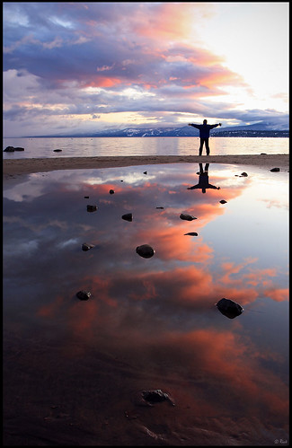
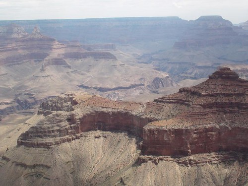
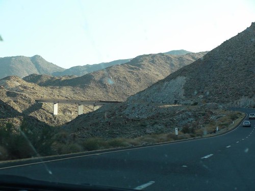
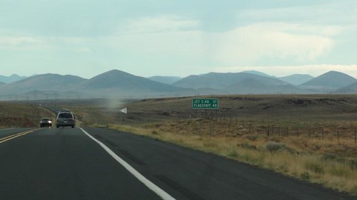
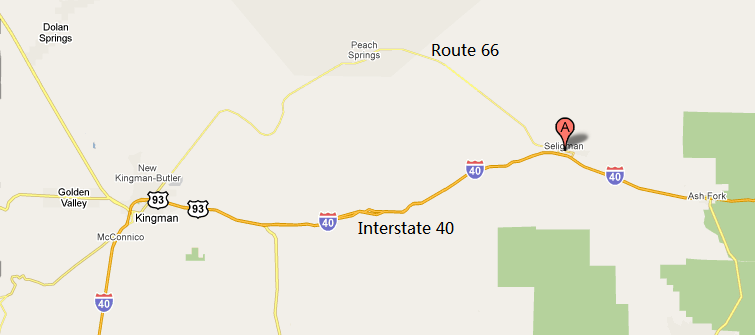
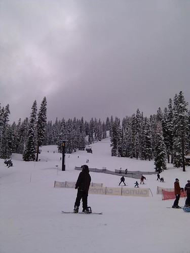
American cities are mostly clean, well planned, well organized, and rule-enforced. I saw the quiet small towns like San Francisco, Palo Alto, Seattle. Even in New York, I see the characteristic of American cities – in certain neighborhood, the style of the buildings – especially the heights of the buildings are pretty similar. In smaller cities like Cappuccino, CA, any small change in the exterior of the house needs approval from neighbors, or the city. I never experienced so much constrain about a building in the America. After watching nice community with decent houses, well cut grasses, and trees, it started to be a little bit …. hmmm… boring.

Las Vegas is the exception

I was completely impressed by the exaggerated buildings of Las Vegas. How can they practice their imagination in such a big scale. Look at the New York New York hotel, which we stayed on our fist night. From the outside, it is a complex consists of all the land markers of New York! They even have a big roller coaster surrounding the building with people screaming days and nights. We stayed in MGM Grand, a hotel with 5000+ hotel rooms. What?! Everyday, I have one sentence in my mind when I was there: “Las Vegas doesn’t have a city committee to approve their building designs.”

There is another city like Las Vegas: Shanghai

In Las Vegas, I was excited. It is like an adventure park – the whole city. The smell in the air, the energy of the people, and the nice restaurants, and services… everything reminds me of another city: Shanghai.

At Las Vegas, I started to understand why so many people from the States feel excited about Shanghai. I lived in that city for 15 years, but I never feel that excited. Why? I just realized it shares something in common with Las Vegas: the wildness, and the energy.

The skyscrapers in Shanghai are the carrier of the most crazy architects in the world. They pour their imagination onto that land which is eager to get the most modern, and cutting-edge designs. People don’t worry about whether the new building can fit into the skyline of the city or not, since the whole city has already been a big mass of mixture between the west, and the east, the old, and the new. Why bother to constrain yet another building? Look at any of the buildings in Shanghai, and think about moving it to somewhere in the world. Paris? San Francisco? Maybe the only place that people will accept buildings as tall as WFC, or as strange as the Bund Center, is Las Vegas. Even people in New York will be concerned.

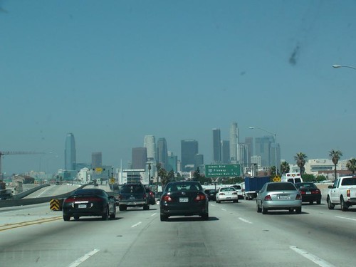
Talking about New York, I have an architect friend who designed many buildings and areas in Manhattan. He complained that if the top 10 most favorite buildings/architects in New York were built today, 7 of them will not pass the current city planning code. Those buildings cannot get a building permit include Brooklyn Bridge, and Empire Building. Since people care their skyline so much, they started to be conservative of any change, and when the “new land” becomes a historical site, they don’t want to change anything.

That is the beauty of new land like Shanghai, and Las Vegas. Just build new things! The skyline has not been widely accepted yet, so build, build, build! Architects in Shanghai started to warn people that don’t be over loose about the control over what building can be built in that city, since “foreign architects will use Shanghai has the test field for the buildings that cannot be built everywhere in this world”. He is correct, and that is the reality of Shanghai today.

Shanghai is spiritually similar with Las Vegas. It is not about gambling, it is about wildness, and imagine nation. To better define Shanghai, I find it a combination of the spirit of Las Vegas in the scale as big as Los Angeles.

San Diego

Arrived at San Diego from Sedona, AZ. It was pretty long trip, but Wendy and I was excited about the few hours on road, especially when we see the few miles of desert at the border of Mexico.

My Impression of US Cities

As anyone, before really setting foot to a place, we have some fixed impressions about it. It may comes from TV series, movie, or a photo. People always make mistakes about the impression.

I thought Las Vegas was just about few streets with some big hotels. I was completely wrong. It is a huge city! From the entrance of I-15, the lights of the cities look like a sea!

My impression about San Diego was also few Mexican style houses, but it turned out San Diego is a modern city with the feeling of Seattle, WA. It is actually the 8th largest city in population in U.S. I now know it is much bigger than Seattle.

From Summit of Summer to Normal Temperature

The outside temperature changes dramatically today. In noon, near Phoenix, it was as high as 113 °F (45 °C), and at night, in San Diego, it is as low as 66°F(18°C).

Travel by car is the best way to learn about geography. The high mountain (called Peninsular Ranges) separate the humid and cool wind (in winters, warm wind) from the ocean. The worlds on the east and west side of the range are completely different, just like the Himalayas separated the comfortable lands in India and the tough climate in Tibet. When you travel, you experience the two world within just few hours. The highest point of the road is 4181 feet at Crestwood Summit (picture), and the lowest point is few feet below the sea level somewhere near El Centro.

I will write more about the very “unplanned”, “stay where I like” style of my trip in the future.

Route 66 and Interstate 40 at Seligman

I am a big fan of the Pixar movie, Cars – the story of a race car, and the historic route 66, the American’s mother road, or the main road.

The movie is a very decent, and thoughtful work with the thought of the impact of modern, and fast life, symbolized by Interstate 40 (I-40), and the old-good-sweet time symbolized by route 66, on the life of the people (like the cars in Radiation Springs town).

Wendy and I was on I-40, and Route 66 yesterday.

It was completely not a planned trip. But it turned out we were on the highway crossing California to Nevada, and finally arrived at Arizona. Driving at 102°F in the middle of the desert, when we finally enter the area with trees, grasses, and mountains, I find out the signs to historic route 66 along the highway.

map-interstate.40-route.66.png

Obviously, the shape of the curved Route 66, and the straight I-40, and the Grand Canyon-like mountains reminded me of the movie cars.

Although Wendy don’t enjoy to leave highway as much as I do, I finally pulled out at a small town called Seligman, AZ. We bought some water, ice cream, and one of the big Route 66 sign in the local super market. Outside the market were many old fashioned store – that type of signs you see in old American movies (including Cars). From the parking area of the super market, we saw cars running as fast as light in the I-40 not far away. On the current Route 66? You can make U-turn as you wish.

When I am at hotel, I did some research, and surprisingly find my intuition was right. Seligman, the two with just 495 people living there, is one of the key inspiration of the Pixar movie Cars. John Lasseter has said in interviews that the town of Radiator Springs in the Pixar film Cars is loosely based on Seligman, although from the name, and location, the town Radiation Springs in the movie is more like Peach Springs on Route 66.

I thoroughly enjoyed the moment of peace, the icecream, and the history of route 66 in the small town of Seligman.

Jet Lag Builds Early Raiser

Jet lag is good thing for me. Whenever in US, or back to Shanghai, jet lag drives me wake up earlier and then I became an early raiser for some days. Thus I have enough time to write more blogs (helping me to get clearer idea about my world, and comprehend the message I got). It is just like an effective “Raise Early” medicine. But the problem is, the effect gets less significant along the day, and I will fade into normal life.

Is there any way to simulate jet lag?

Travelogue of Tahoe

On Sunday, we were back from Tahoe with just 3 hours and a half on the road – comparing to the 9 hours on snowy Friday night, it is much better. When I finally find time to sit down, I can start to write a travelogue about my trip to Tahoe.

Where is Tahoe

Although most people in the States should know where it is, it worth some time to tell other readers where the beautiful lake is.

It is 200 miles east of San Francisco, at the border of California and Nevada.

map-tahoe.png

The transpiration is pretty straight forward – take the I-80 from San Francisco, passing the Bay Bridge, and drive all the way to the east for 180 miles, and take CA-237. Then you are there.

You cannot Ski without Snow

On the way to Tahoe, it snowed heavily, and it was the most heavy snow I experienced in recent years. Look at the photos below and imagine the snow!

Photograph by Jian Shuo Wang

Photograph by Jian Shuo Wang

Photograph by Peng Linlin

Photograph by Peng Linlin

It took us 9 hours to get there.

The Shining Sky with Snow

The Ski Field

Look at the nice ski field. It is obviously bigger than the indoor ski in Shanghai.

We took the lift up to the top of the mountain.

My First Fall

I started with a mild slope, and the speed went up so quick, that I had no choice but to run into the side snow to stop. Look at the first fall: The both ski completely get into the snow, and it took me quiet some time to get out.

My Legs!

For entry-level skier like me, I used all the effort to ski as slow as possible, thus using the ski as brake from the top of the mountain to the bottom. My legs just got so tired that it started to hurt, and I have to stop from time to time in the middle of the slope. When other more skillful guys camp and eat energy stick on the top of the mountain, I had a nice pizza near the Ritz-Carlton.

Mid-Mountain

When we skied in the afternoon, it snowed heavily. I took the time to take a picture of the snow covered mountain and the snow before I rush down the slope.

Taken from the middle of the mountain

Finishing the Great Ski Journey

At the time when Village Express stops operation, we have been on the slop for 5 hours.

Photo taken by a nice girl near us

Street Names in America is Mystery – Part II

After I wrote Street Names in America is Mystery, there are many great reply. Many of them are already published in the comment section of that blog entry (problem of scattering content everywhere on the Internet), but many came from Google Buzz, and email. The answers are very good, and I want to share it with you. Thanks my friends for always so kind to help me out.

Song Li

basically, as long as you do not create a name conflict in your city’s street name space, and it’s not anything nasty, the local resident, i.e. company or real estate developers can choose the name. Say Apple’s headquarter: 1 Infinite Loop, pretty smart name you-know-why.

For some cities like Seattle, street names are numbered so that people know exactly where they are by reading the street / ave numbers.

If you look at how many street types are there, you will find it even more interesting: blvd, ave, st, ln, pl, ct, ter, etc etc

Robert Mao

I feel city like Seattle’s naming strategy is typical American: 实用但没文化 :) Feb 21

Song Li

@Robert, yes, it’s engineering’s way of thinking, quite practical. I only start to miss Seattle’s street naming convention the night I first drove in San Jose – almost all streets start with “San “, and you don’t know when some west street is actually heading south.Feb 21

Jian Shuo Wang –

The Seattle naming convention is very practical. I actually love it, the MIT style

Shengquan Liang –

Street names near bay area seem follow a different route. Like “El Camino Real” is everywhere, maybe it was an exception? Places like Chicago push the MIT style to another extreme, the street number could be used to measure the distance (#/8) to city center…Feb 21

Jian Shuo Wang –

What is the naming system in Chicago? Didn’t notice that.

Shengquan Liang –

There is a pretty good summary of Chicago’s grid system here:

http://www.chicagohomeestates.com/info/chicago_street_guide

It is a grid indeed.

Robert Mao –

El Camino Real is a long road. I think EI and Real is from Spanish. “Real” is “road” in spainish I guess.

Maile even sent me a long email explaining this:

Dear Jianshuo,

I saw your post on Buzz, so I thought I would add to the conversation…

El Camino Real does come from Spanish. It means the “royal path/road.” Camino just means “path” or “road” or “route.” Real means “royal.” El is just “the.” You can read more here.

Alma and Serra are also Spanish. Alma means “soul.” Serra comes from the verb “to cut” or “to saw.” It has the same Latin root as the English word “serrated” (like a serrated knife). However, Serra is also a family name, and it was the name of a Franciscan missionary (Junipero Serra), who was involved in establishing several Catholic missions in California in the late 1700s. Maybe Serra St. is named for him?

Quarry is an English word. It means a place to take stones or minerals from the earth (a limestone quarry, for example), a bit like a mine.

Hans is a Germanic name. Perhaps it was the name of an important person, or just an ordinary person, who lived on this street.

Many, many streets in California have Spanish names and this is because California was part of Mexico (and before that even, Mexico was part of “New Spain”). I don’t know a lot about this history, but maybe you can look up something about the Mexican-American wars (after which California officially became a part of America). Many of the towns start with “Santa.” This means “saint.” This goes back to the Catholic tradition–when there were many Spanish missionaries in the area. Santa Ana is Saint Anne. Santa Monica means Saint Monica. San is the masculine form of Santa, so it also means “saint.” Except, you will always see a masculine name after San, such as San Francisco, which is a bit like Saint Francis. Los Angeles means “the angels,” which is why some people refer to it as “the city of angels.”

Each region of America has different rules/reasons for street naming. In Boston and New England, you have a lot of old English names which refer to places in England, such as Marlborough, Essex, Gloucester. And in the old, commercial parts of towns and cities, you have simple names, such as “Water Street,” “Milk Street” and “School Street.” Very often, these streets were named for the activity which took place there, so very likely, there was once a school on “School Street.” And often you have street names that are taken from the names of people or powerful families, such as Cabot, or Lodge, etc.

I grew up in Hawaii, and by law, all of the street names must have some relationship to Hawaii, or be a Hawaiian name. For example, I lived on Manu Mele Street, as a child, and in Honolulu, there is a very big street called Beretania, which was the Hawaiian word for Britain (because it was the British who were the first Westerners to discover Hawaii).

Usually, when you see a city where the streets have a kind of logical system, such as numbers or letters, it means that it was a relatively modern city development–it was planned, or at least, that part of it was. So if you look at New York, the bottom of Manhattan is kind of a mess, and the names are more basic, such as Broad Street, Wall Street, Church street. This is the oldest part of the city. As you move north, the streets are numbered and very straight and organized. This part was where the city started really planning its development.

I think this is a very interesting topic. (I’m very interested in language, names, history, etc.) I’m no expert at all, but I hope this can be a bit helpful, or interesting for you.

Enjoy your stay in California.

Best wishes,

Maile

Hello from Palo Alto

Just landed. Palo Alto is much nearer than San Jose. This is the first time I stay in Palo Alto. The previous many time, I was always in the San Jose area.

Just landed. Stayed at 3200 El Camino Real – the Super 8 Hotel, a cheap hotel that I stayed once the last time. The United Airline UA 858 flight I just finished was the worst experience I had so far. I may write about it. Even the crew felt that it is so bad that they gave many of us a “Please Accept Out Apology” card, and a series number on it. With the card, I can get 10% off from the next international trip, or $150 certificate…

When I left eBay and started the adventure journey, I know as a company, we have made a decision to be on our own, and the journey of low cost operation. I no longer stay in five star hotels, and no longer fly business class – I said goodbye to my business class seat the last time I flied, and I know, for a very long time, evern when economy allows, to stay low cost is the right thing to do – Bill Gates always fly economy long after Microsoft became the software giant.

The next thing for me to do is to find a PHO restaurant as soon as possible – get the noodle and then sleep.

Update This is noodle house I went to finally.

Bye Bye Shanghai for Few Days

I just packed everything, and a taxi is waiting downstairs to Pudong Airport. I am leaving for San Francisco Airport, and stay in Palo Alto for some days – near the Stanford university, and be back to Shanghai at night of July 10th.

Bye bye Shanghai for a while, and I will be back soon. I don’t expect the trip will interrupt blogging – I will just suffer a little bit of time zone difference, and not sure how to keep the one post per day guideline – so I just post “randomly” when I want to.

Checklist for US Trip

I am heading to US via UA858 tomorrow. As always, I always wait for the last minute to pack up everything. ENFP is not compatible with GTD.

The first US trip made me excited for weeks ahead of it, and now, it becomes another working day. However, my personality type always welcomes difference, and loves something new, not routine, and travel (including business travel) is the most exciting thing.

The improvement this time is, I made a check list of important things:

  1. Passport (verify that the Visa is still valid)
  2. Credit Card (one main and one backup)
  3. 100 USD cash + some changes.
  4. Driver’s License and an English translation (Translation is optional for SFO)
  5. Laptop and chargers
  6. Two mobile phones and chargers
  7. Network cable
  8. My notebook and several pens
  9. My name card
  10. Small gifts

I am on UA858 tomorrow the whole day, and it is again, the longest day in summer, starting from 0:00 AM, June 2, 2009, and ends at 15:00, June 3, 2009 – 39 hours. If I travel in winters, the day will be even longer – 40 hours because of the Day Light Saving.

See you in US.

P.S. In case you haven’t followed this blog long enough, I am flying to San Francisco

P.S.2 Ashish, I really cannot fly to your city. The next time, OK?

Conversion of San Francisco and Beijing Time

I do not do as much conference calls as before, and I don’t use an advanced scheduling system called Microsoft Outlook (TM), so I often mass meetings up. After booking three meetings wrong, I decided to really look into the details of how time zone, daylight saving works.

Converting San Francisco Time to Beijing Time

Although there are many tools doing the conversation, I found many tools converted the time wrong, since the new change of the Energy Policy Act of 2005 in US extended one month of daylight saving

locks were set ahead one hour on the second Sunday of March (March 11, 2007) instead of on the first Sunday of April (April 1, 2007). Clocks were set back one hour on the first Sunday in November (November 4, 2007), rather than on the last Sunday of October (October 28, 2007).

— Wikipedia contributors, ‘Energy Policy Act of 2005’, Wikipedia, The Free Encyclopedia, 16 June 2009, 01:21 UTC, <http://en.wikipedia.org/w/index.php?title=Energy_Policy_Act_of_2005&oldid=296664740> [accessed 16 June 2009]

That means, pay attending to the change from March to November.

When it is hot (summer time), the difference between Beijing and San Francisco is becoming less (from formal 16 hours to 15 hours).

The strict way to do the calculation is, always add 15 hours in summer time or 16 hours in winter time to San Francisco time to get the right Beijing time.

For example, a meeting starts at 7:00 PM, June 20, 2009 = 10 AM, June 21, 2009 – my most preferred time to call.

A easier way is to flip the AM and PM, and advance by 3 hours in hot time, and 4 hours in cold time.

Beijing Time to US Time

The way to calculate it is also easy: flip the AM and PM, and backward 3 hours (in hot time), or 4 hours (in cold time).

Hope I can always do the calculation right.

What time is it now? 22:43:37, June 23, 2009 – that is 7:43:37, June 23, 2009 in US.

P.S. China adopted Day Time Saving, but abandoned the practice.

Visiting US in July

Visiting US from July 1 to July 9.

Always United Airlines – haven’t tried other airlines yet.

Always Avis – haven’t tried other car services yet.

Alternatives? Richard suggested JetAirways, but they have discontinued their service from Shanghai to San Francisco.

Moving to Pudong?

It is a tough decision about whether to move back to Puxi near my office in Xujiahui. I moved to Pudong 5 years ago. Now the traffic is really a problem. But, am I ready to move back to Puxi? Seems today, I am making some progress.

Shanghai is Not Hot

I am still not using air conditioning in my home yet. It is almost July. Shanghai is not that hot this year.

I am in Nanjing tomorrow

I will visit Nanjing tomorrow to attend a small-scale meeting, and will get back. Do you want a meetup? Late minute meeting notice is always my style.