Yangshan Deep Water Port – Part II

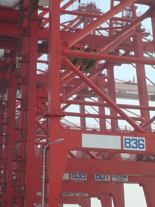
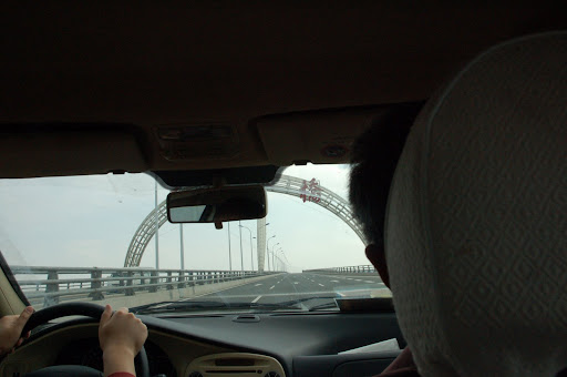
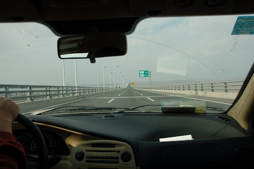
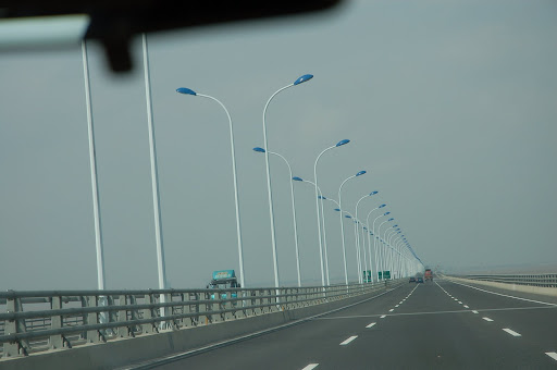
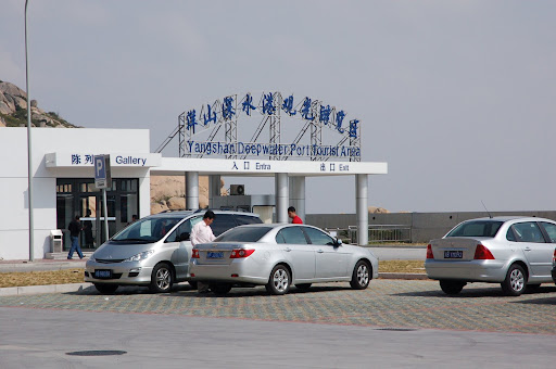
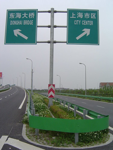
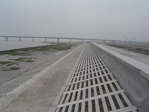
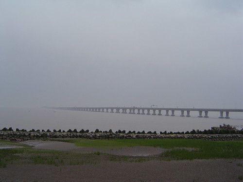
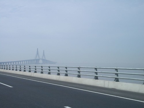
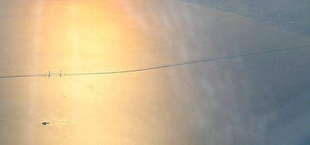
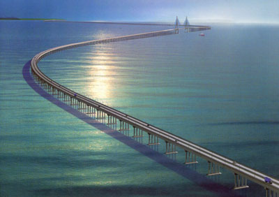
I am attending a meeting at Yangshan Island. Here are some photos of the Donghai Bridge, and the Yangshan Deep Water Port. This is a meeting with government. I just found out that Yangshan is a great place to host a meeting – it takes about 2.5 hours to get there, including 0.5-1 hour to reach the A2, and 30 minutes on the A2 to Donghai Bridge, and 30 minutes on the bridge (at 80 km/hour), and 30 minutes on the boat from Xiao Yangshan to Da Yangshan. Here are some photos I took on the way there.

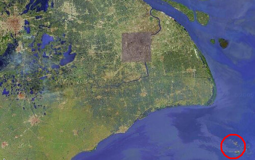
Where is Yangshan Port?

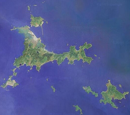
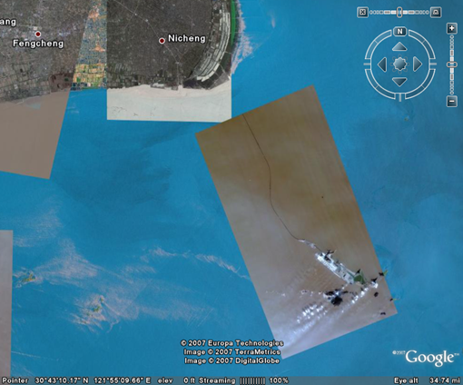
Google earth just specially updated the Yangshan Port area. On the satellite image below, you can see part of the bridge, and the part on the mainland is not updated – you should see a huge lake there in the current sea area.

image

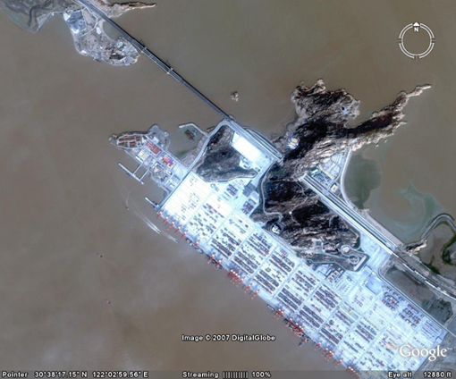
It seems the recent updated Google Image has much higher resolution than before. Look at this one:

image

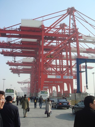
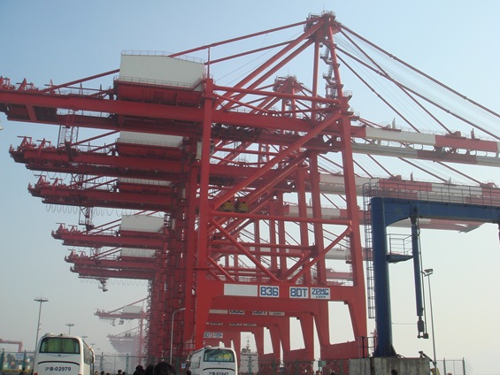
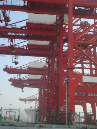
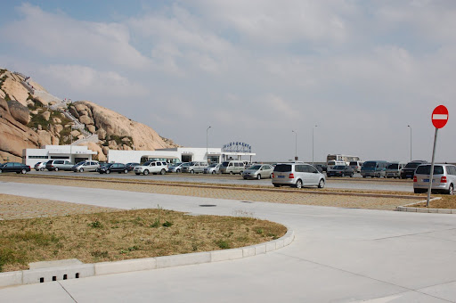
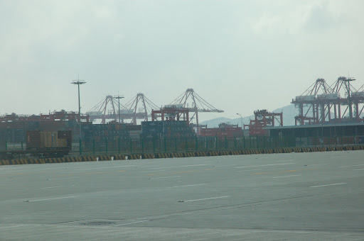
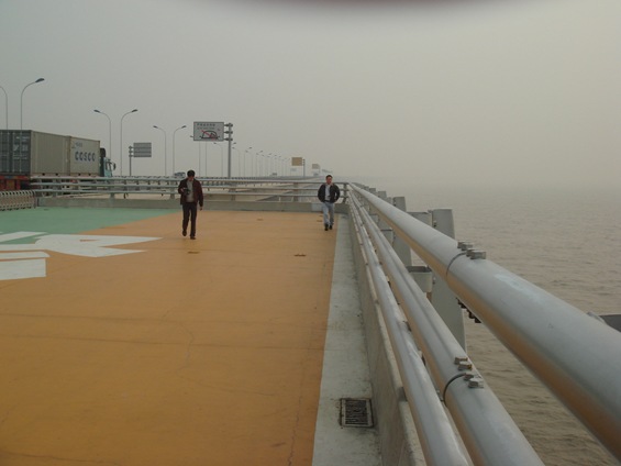
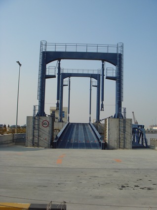
The bus stops at the Emergency Area, so we can take some photos of the port.

DSC02059

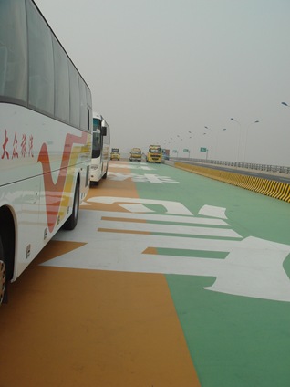
This is the platform – big enough for helicopters to land. There are several this kind of facility in the 32.5 km long bridge.

DSC02060

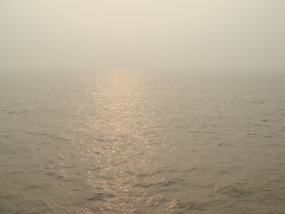
The water of the East China Sea is highly polluted, and it is all yellow.

DSC02061

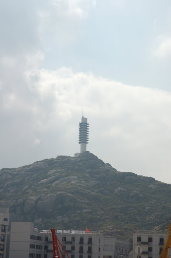
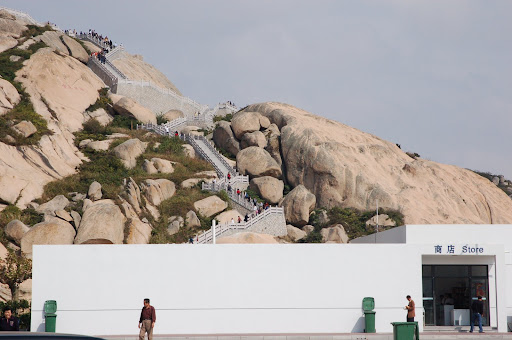
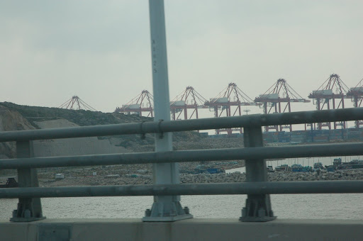
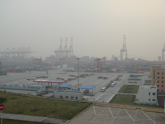
From the top of the hill looking down to see the whole port area.

DSC02065 

    DSC02070

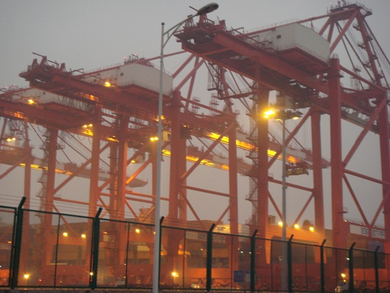
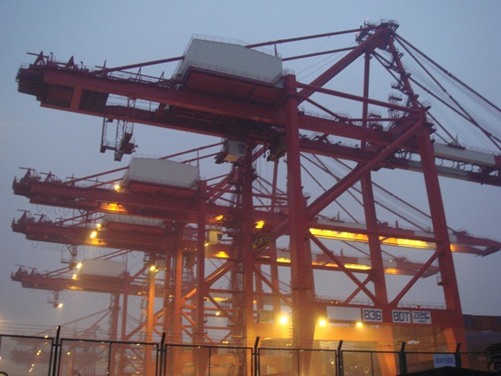
The night of the Yangshan Port.

DSC02071

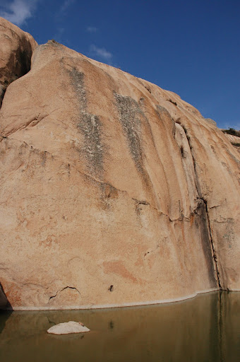
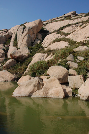
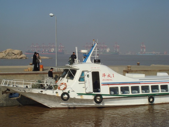
This is the photo I took this morning when we returned from the Da Yanshan Island.

DSC02089

This is the view from the harbor of Da Yanshan Island, looking at the Xiao Yangshan (where the port is located). The fast ferry only takes 15 minutes to get to the other side.

 DSC02081

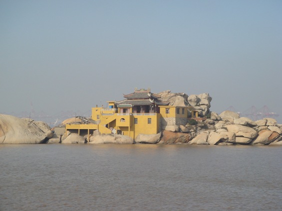
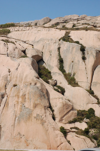
This is the temple fishers go to before they sail into the sea.

  DSC02083

DSC02084

DSC02085

 DSC02086  DSC02088

Photos of Donghai Bridge

Wendy, her parents, Yifan and I went to the Donghai bridge today. It is the second time for me to get onto the bridge, and the first time for others. Maybe is the second bridge Yifan has ever been to (with the first one as Nanpu Bridge).

You can check my previous entry on Donghai Bridge to know the background of this bridge.

To be short, it is the longest sea bridge in the world with 32.5 km on the sea, and another about 10 km on the land or the Yangshan Deep Water Port.

This time, I took my camera with me so I can show you a little bit of the bridge, and the island.

Below: Entrance of the bridge.

Photograph by Wendy

Below: The road on the bridge – we continued on this road for 15 minutes.

Photograph by Wendy

Photograph by Wendy

Below: Rocks of the Yangshan Island

Photograph by Jian Shuo Wang

Below: Control tower on the top of the hill.

Photograph by Jian Shuo Wang

Below: At the entrance of the Yangshan Tourism Area. They offer walking path on the hill so people can see the whole port. Since Yifan was with us, we didn’t take the challenge (and pay 30 RMB) to go along the path.

Photograph by Jian Shuo Wang

Below: These kinds of rocks are very rarely seen in Shanghai.

Photograph by Jian Shuo Wang

Photograph by Jian Shuo Wang

Photograph by Jian Shuo Wang

Below: Parking lots at the tourism area.

Photograph by Jian Shuo Wang

Below: Rocks again. Next time I go there, I will make sure I climb to the top of the mountain. Yangshan is, anyway, the second hill in Shanghai.

Photograph by Jian Shuo Wang

Below: The entrance of the tourism area.

Photograph by Jian Shuo Wang

Below: This is the path to the hill.

Photograph by Jian Shuo Wang

Below: the tunnels on the Yangshan Island.

Photograph by Jian Shuo Wang

Below: The port area.

Photograph by Jian Shuo Wang

Photograph by Jian Shuo Wang

For more photos, please check my Donghai Bridge Photo Collection.

Exciting Donghai Bridge and New Habor City

What is my favorite suburb place to go in Shanghai (with the context that I have a car)? It changes along with time. Here are some places on my previous favorite list:

  • Sheshan 佘山, the only mountains in Shanghai. Don’t laugh if you know it is only 99 meters high – 1/2 of the building I work everyday, and 1/4 of the tallest building in this city. They just built a wonderful lake nearby.
  • Fengxian 奉贤 Sea Shore. It is south of Shanghai. You can see the sea there – the sea is yellow, and there is no way that you can swim there. Recently, the local government spent huge to bring sands from Dalian 大连 and created a artifical sand land there. Hope the water will be better.

Now my list added a new one – Dong Hai Bridge and nearby Habor City. Let me tell you how to get there, and what you can expect in this new land in Shanghai. I recommend you to go there and experience.

Transportation

By Car: use A20, and turn A2. It is the end of A2. There is a large conjunction at southeast corner of A20 ring road. It has two branches, one is A1, going to Pudong Airport, the other is A2, going to Donghai bridge.

From Pudong Airport: They just opened a new shuttle bus, Pudong Airport Shuttle Bus No. 8, connecting Pudong Airport (PVG) to Dong Hai Bridge.

From downtown: Take Metro #2, and transit to Longgang Express 龙港快线.

Pictures

More photos

Update May 3, 2006

Here are more pictures taken by Run Liu or Linda.

Photograph by Linda or Run Liu

Visited Yangshan Deep Water Port

Yangshan = 洋山

This is the satellite image of the island Shengsi 嵊泗 we went to.

Image credit: Google Map

Before I talk more about my trip in Shengsi, the island in the East Sea, let me talk more about the Yangshan Deep Water Port.

The Yangshan Island

In the East Sea, about 30 KM away from land of Shanghai, there are two big islands. One is called Little Yangshan Island, and the other is called Big Yangshan Island. You can see the islands in this satellite picture.

Image credit: Google Map

They are several islands that are not far from Shanghai. No one ever lived there. Shanghai needs a deep water port. The Yangtze river is only 7 meters in depths, and the Huangpu River is around 7-8 meters in depths. Large ships (like third or forth generation ships) cannot go into the river. They can only park in either Ningbo Port or Dalian and transfer the goods onto smaller boats and get into the river.

Shanghai want to build a world class deep water port that the larger ships can park. In the Yangshan Island area, the water depth is more than 15 meters, suitable to be a big port.

The project was started several years ago, and in 2005, the first phase was completed.

Dong Hai Bridge 东海大桥

I talked about Donghai Bridge last July. I wanted to visit the bridge, but at that time, the bridge was not completed.

This trip, we had the opportunity to go through the bridge. It is maybe one of the longest bridge in the world – 32.5 KM in length. It extends from the Luchaogang area in Nanhui District into the Hangzhou Bay.

How do you think if your bus runs at top speed on a bridge on the sea, for 20 minutes? It was really amazing experience for us, especially for people who never heard of the bridge. I can imagine how confusing people get after 10 minutes on the sea.

Shanghaiist guys has a picture of part of the bridge. It may be taken from a aircraft.

Credit: Shanghaiist.com

This picture is just a small part of the bridge. The bridge is at least 3 times longer than the part shown on the picture.

Entrance Permit

I can imagine how busy the bridge will be if a 500K-ton ship arrives at the port – if all the trunks are occupied to unload the goods, it may take weeks to get all the goods out.

Currently, private cars are not allowed to enter the port area. There are public buses. Here are some route.

1. Go to the Nanpu Bridget (the ground of the Puxi side). Then buy ticket to Shengsi (90 RMB single trip). They will have a bus to take you to Luchaogang, and then enter the port. You get on board the ferry to Shengsi at Little Yangshan Island.

2. Or you can drive to Luchaogang via A2 Expressway, and then transfer to a bridge tour bus (9 RMB? No confirmed) to go to the island.

I have some pictures, but not with me. Will share later.

P.S. Dinner with Xiaofeng

Xiaofeng is going back to bay area, and will move her company to Beijing afterwards. We had dinner at Face in Ruijin Hotel. I ate too much, and my stomach still hurt now. In the future, we should not eat that much, no matter how good the food is.

Donghai Bridge

Donghai Bridge is under construction. It is one of the most interesting projects I know besides the World Expo and the Hangzhou Bay bridge. The 32 km long bridge will extend to the island at the heart of the Hangzhou bay and it is the first bridge that will enable us to drive onto an island in Shanghai. The A2 expressway connects A20 and the bridge.

This is how the bridge will look like after completion.

shanghai-donghai.bridge.jpg

Image in courtesy of Eastday.com

More Dong Hai Bridge pictures

At around 5:30 PM, I don’t know why but Wendy and I suddenly decided to drive there and see this bridge. It is not too far away from our home – 41 km means 30 minutes’ drive. We started from A20. When we turned right onto A2, as I expected, we are the only car on the newly completed express way. I believe it is safe to claim that A2 is the express way in Shanghai with the best traffic condition – I never saw a car before me or after me and only saw about 5 cars on the opposite direction.

The Chief Architect’s speech on TV last year, when the major part of the bridge completed, was very misleading. He welcomed people to drive to visit the bridge but it turned out that the area is still a big construction site. Huge, yes, really huge tractors and big carts run along the narrow roads, and my car looks so tiny on the road – just like a rabbit playing among the elephant. Within 20 minutes, we decided we’d better returned to A2, where we are the biggest vehicle on the empty expressway. I didn’t take any pictures – maybe next time, and when we returned to near my home to have dinner, it was about 8:00 PM. According to the report, when the bridge is completed, I can directly drive to the island in the sea, and transfer to fast boats to the other beautiful island nearby…