It has been a while since I last draw the diagram of Shanghai Expressway. Compared to the old map I draw, I feel I grew up a little bit in the last 4 years.
Here I proudly present the new Shanghai expressway map as of 2010.
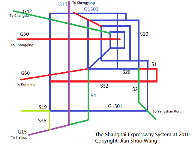
©Jian Shuo Wang
Let me give you a little bit explanation.
The Rings
There are basically four big ring expressways in Shanghai – the four blue square.
The Inner Ring Expressway (no numbered name)
The Middle Ring Expressway (no numbered name)
The Outer Ring Expressway (S20, formally A20)
The Suburb Ring Expressway (G1501, formally A30).
The G1501 is not completed yet (you can see absence of a corner at northeast side).
The four rings become the back bone of the transportation systems in Shanghai.
A fact that many people ignored was, although they are called Ring Road, they are not circles. Instead, they are more like a square. Pay attention to most of the corners, and you will see that it is well designed. The rings formed GRID, instead of some hard to handle round corners.
The Radiation Lines
From the rings, especially the S20, the Outer Ring, the radiation lines point out from Shanghai. They are basically the same road, but with a new name (G60 as example)
Now, the G42 goes from Shanghai to Chengdu (via Nanjing)
G50 goes to Chongqing
G60 goes to Kunming
S1 goes to Pudong Airport
S2 goes to Yangshan Deep Water Port
S4 goes to Jinshan and merge into G15
S36, and S19 connect the southwest corner of S30 to nearby expressways
National Expressway
Besides the radiation lines, G15 is the National Expressway from Shenyang to Haikou, passing Shanghai.
G1501 is named after G15. The 0 in the name implies a ring, and the 1 means the first round-city ring along the G15.
S32
The only one left without an explanation is S32, formally A15. That is one of the most impress highways in Shanghai, although it does not have a simple name as G60, or S30…
S32 starts from Pudong Airport, and goes all the way west and reaches G60.
If you drive from Hangzhou to Shanghai, far before you get close to the downtown Shanghai, you will see a sign pointing to Pudong Airport. That is the starting point of S32!
Enjoy the nice Shanghai expressway system.
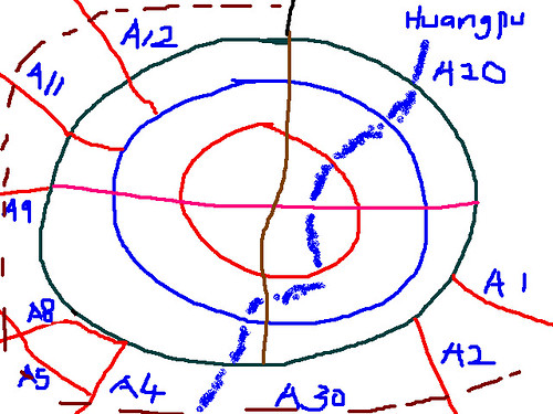
P.S. My naive drawing 4 years ago
There is a little difficulty in understanding the diagram if not given any explanations for the new souls.
Fortunately you explained it pretty well and i appreciate your amazing job.I may use it the other day.
Thanks Viva. I forgot to mention at the center of the inner circle – near the red horizontal line (G50) and blue vertical line is People’s Square, the city center.
somehow I can’t see the new map, although I can see the old one.
@James, it is hosted on flickr.com, and it is blocked from time to time by our beloved government.
Hi, it’s a nice map.
Are the ring roads expressways in Pudong? Or are some of them more like regular roads, with traffic lights? Puxi has many elevated roads but I don’t remember so many in Pudong. Of course I was not there since 2009, it’s probably very different now! :)